The Civil Aviation Authority (CAA) regulates civil aviation in New Zealand. Anyone operating a drone or unmanned aerial vehicle (UAV) must comply with applicable CAA rules and regulations. Responsibility for complying with CAA rules rests with the drone operator.
To help ensure the safety of people, property, and other aircraft, drone/UAV operators must:
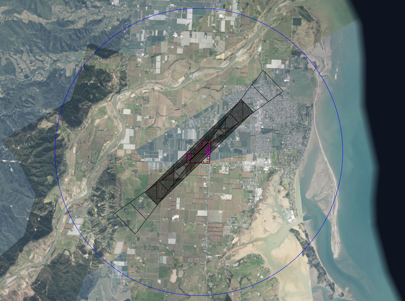
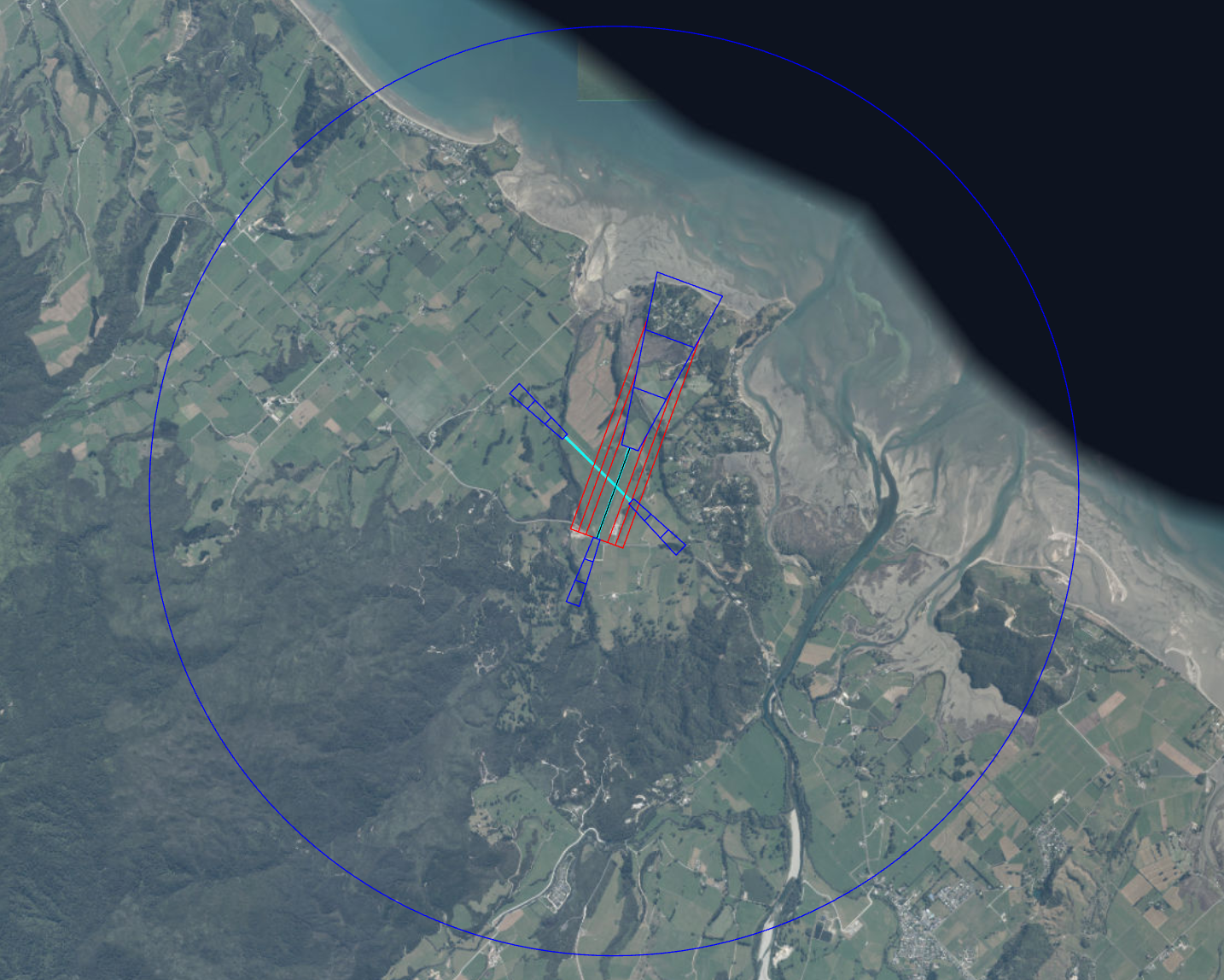
Not fly within 4 km of Motueka or Takaka Aerodrome until you have met all specific conditions – see section below
Not fly directly over people or private property without their prior consent.
Not operate within controlled airspace without the required authorisation, unless undertaking a shielded operation in accordance with CAA rules.
Keep the drone/ UAV in your own eyesight at all times. Do not fly above cloud or fog or behind objects.
Only operate during daylight hours, unless undertaking a shielded operation.
Ensure the drone/ UAV weighs under 25 kg and is safe to operate and properly maintained.
Take all practicable steps to minimise hazards to people, property, and other aircraft.
Tasman District Council is not responsible for monitoring or setting these rules. For further information on these CAA regulations, visit their website(external link).
Please note: Part of Tasman District (including Rabbit Island, Rough Island, the Waimea Plains, Eves Valley and parts of Redwood Valley and the Richmond Range) sits below the Nelson controlled airspace. This means that if you want to fly anything in that airspace, you need permission from Nelson Airport Air Traffic Control.
Provided you follow the Civil Aviation Authority (CAA) operating rules and subject to conditions, you have Tasman District Council’s permission to fly unmanned aircraft over Council land, with the exception of:
Māpua precinct and wharf area, and Waterfront Park;
Washbourne Gardens;
Pethybridge Rose Gardens;
Tākaka Memorial Gardens;
Rabbit Island/Moturoa beachfront;
Pearl Creek Reserve;
Hoddy Estuary Park;
Research Orchard Reserve;
Higgs Reserve;
Council cemeteries;
Motueka sandspit (Council owned portion. Refer to the Department of Conservation on rules for its portion of the spit);
any Council land that is leased to another party (e.g. bowling greens, tennis courts, grazing licences);
any location on Council land during an organised gathering of people (including sporting events);
any Council land where there is Council signage that specifies that use of UAVs is not permitted; and
Tākaka Aerodrome and Motueka Aerodrome (see above for details).
The operation of the UAV over Council land must not occur during and in the vicinity of an emergency event, including any civil defence, ambulance, fire or police operation, except by the emergency services responding to the event.
All the New Zealand Civil Aviation Rules (NZCAR) are fully complied with.
The UAV operator is courteous of other users of Council land, who are often there for quiet enjoyment of the area
The flight occurs at least 100m away from and above any nesting or roosting birds (such as godwits, banded rail, terns, NZ dotterel)
The UAV is used in a way that does not involve chasing or harassing any stock or wildlife
The UAV operation is ceased immediately at request by Council staff
Where the UAV is powered by an open flame (e.g. hot air balloon, rocket or jet turbine), the operation occurs outside of fire ban periods.